
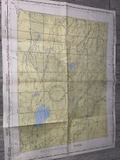
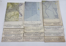
World Aeronautical Charts Maps US Air Force Ed Lot Of 12 29"x22” Used Vtg 1950s For Sale

When you click on links to various merchants on this site and make a purchase, this can result in this site earning a commission. Affiliate programs and affiliations include, but are not limited to, the eBay Partner Network.

World Aeronautical Charts Maps US Air Force Ed Lot Of 12 29"x22” Used Vtg 1950s:
$70.00
World Aeronautical Charts Maps US Air Force Ed Lot Of 12 29"x22” Used Vtg 1950sGood to fair used condition, some writing and markings present, some toning, crease/edge wear. The Kanawha River map has some minor holes and chipping. I didn't measure each map, but they are all approximately 29" x 22".
Maps Featured are:Galveston Bay, Boston Mountains, Great Smoky Mountains, Chesapeake Bay, Edwards Plateau, Mobile Bay, Lake Okeechobee, Sanitago Mountains, Lake Erie, Palmico Sound, Kansas River and Kanawha River.
Related Items:
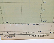
Laysan Island World Aeronautical Chart 1952 Hawaii Vintage Map
$9.50
world aeronautical chart koko lake china 1947
$100.00
World Aeronautical Charts Maps US Air Force Ed Lot Of 12 29"x22” Used Vtg 1950s
$70.00