
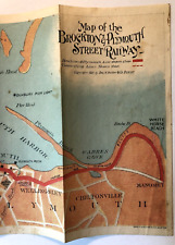
TROLLEY MAP 1901 The Brockton & Plymouth Street Railway STREETCARS Massachusetts For Sale

When you click on links to various merchants on this site and make a purchase, this can result in this site earning a commission. Affiliate programs and affiliations include, but are not limited to, the eBay Partner Network.

TROLLEY MAP 1901 The Brockton & Plymouth Street Railway STREETCARS Massachusetts:
$42.50
Map of the
Brockton & Plymouth Street Railways
Published Boston, MA, Geo. H. Walker & Co.
1901
The coloredmap measures 22 ½ x 6 inches, creased as issued, some staining on the map andmargins, see photos, otherwise in good condition.
The mapdepicts the route highlighted in red from Manomet to Brockton.
Tippedon to the map is a one-page description of “Where to take Cars for Plymouth.From Boston. From and City or Town in Southeastern Massachusetts.”Illustrated with a b&w photo of 2 trolleys with people standing alongside.
A trulyscarce trolley map, it will be a nice addition to your collection.
Mainstreetbooks has been afamily business for more than 30 years. We focus on fine books, historicalephemera, early photography. We maintained a storefront in Amherst, MA for over10 years, and we have been selling on since 1999. Our response speaks foritself so offer or purchase with confidence and please take a look at our otherinteresting books, ephemera and photographs. We pack carefully, ship quickly,and have thousands of happy customers. Thank You,mainstreetbooks
Related Items:
TROLLEY MAP 1901 The Brockton & Plymouth Street Railway STREETCARS Massachusetts
$42.50
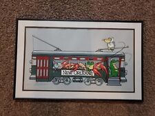
Vintage New Orleans Streetcar Picture Framed Signed Numbered
$100.00
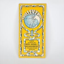
Rare 1910 Boston & Northern Old Colony Street Railway Brochure Map Trolley Lines
$124.00