
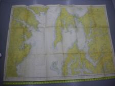
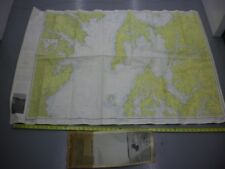
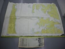
C&GS Navigational Chart 550 Chesapeake Bay Eastern Bay-South River Jan 1967 For Sale

When you click on links to various merchants on this site and make a purchase, this can result in this site earning a commission. Affiliate programs and affiliations include, but are not limited to, the eBay Partner Network.

C&GS Navigational Chart 550 Chesapeake Bay Eastern Bay-South River Jan 1967:
$27.96
UP FOR SALE IS A VINTAGE C&GS NAVIGATIONAL CHART #550 CHESAPEAKE BAY EASTERN BAY-SOUTH RIVER DATED JAN 2, 1967. IT MEASURES 47" X 35" AND IS SUITABLE FOR FRAMING OR OTHER DECORATIVE USES. I SHIP WITHIN 1 BUSINESS DAY OF RECEIVING CLEARED PAYMENT AND TRY TO ANSWER ALL QUESTIONS.
Related Items:
C&GS Navigational Chart 550 Chesapeake Bay Eastern Bay-South River Jan 1967
$27.96
C&GS Navigational Chart 550sc Chesapeake Bay Eastern Bay-South River 1969
$27.96
C&GS Navigational Chart 551sc Chesapeake Bay Choptank River-Herring Bay 1969
$27.96