
Large Original 1898 Antique Map VIRGINIA Norfolk Hampton Chesapeake Alexandria For Sale

When you click on links to various merchants on this site and make a purchase, this can result in this site earning a commission. Affiliate programs and affiliations include, but are not limited to, the eBay Partner Network.

Large Original 1898 Antique Map VIRGINIA Norfolk Hampton Chesapeake Alexandria:
$28.80
Original 126-year-old Antique Map of Virginia Drawn and Engraved for the 1898 Edition of The Columbian Atlas of The World, Featuring Large Scale Color Maps of Each State, Principal City, and Territory of The United States, the Provinces of Canada, Every Country, Nation, Sovereign Kingdom, and Civil Division Upon the Face of the Globe; Accompanied by a Margin Reference Index of County, City, and Town populations of the 1890 US Census; Together with a Concise History of Earth's Peoples richly Illustrated with Engravings. Intricate Detail of County Lines, Towns, Railroads, along with Rivers, Lakes, and Natural Landmarks. Fine Map for the Historian or Collector. Great for American History and Family Genealogy. Makes an Imaginative and Creative Gift. Easily Framed. Original Map Drawn & Engraved for the 1898 Edition of The Columbian Atlas of The World, Featuring Large Scale Color Maps of Each State, Principal City, and Territory of the United States, the Provinces of Canada, and Every Country, Nation, Sovereign Dominion, Kingdom, and Civil Division Upon the Face of the Globe. NOT A REPRODUCTION. Accompanied by a Reference Margin Index of Every County, Chief City, and Principal Town, along with Population and Demographics according to the 1890 US Census; Together with Historical, Geographical, Descriptive, and Statistical Data pertaining to Each; Including a concise History of the World's Peoples Richly Illustrated with Engravings, Intricate Detail of County Boundaries, Cities, Towns, Railroads, along with Rivers, Lakes, and Natural Landmarks. Published by Garretson, Cox, and Co., Buffalo, New York: 1898; a Copy of the Title Page of which Included. Fine Map for the Collector or Historian. Great for American History and Family Genealogy. Makes an Imaginative and Creative Gift. Easily Framed. Exceptional Color.Intricate Engraved Detail. Large Map: 11" x 14" Map is in Excellent/Very Good Condition. No writings, folds, or tears. Mild foxing. A Few of the Cities, Towns, Counties, Railroads, and Landmarks Shown on the Map Include: Richmond, Norfolk, Petersburg, Lynchburg, Roanoke, Alexandria, Danville, Portsmouth, Newport News, Arlington, Manchester, Staunton, Charlottesville, Salem, Suffolk, Fredericksburg, Winchester, Berkley, Lexington, National Soldier's Home, Bristol, Luray, Pocahontas, Bedford City, Harrisonburg, Hampton, Farmville, Pulaski City, Radford, West Point, Martinsville, Williamsburg, Alleghany County, Accomac County, Amelia County, Chesterfield County, Floyd County, Princess Anne County, York County, Prince George County, Warrenton, Boston, Clifton Forge, Marion, Abingdon, Houston, Phoebus, Tazewell, Vinton, Buena Vista, Graham, Ashland, Crewe, Fair Port, Fincastle, Herndon, Fortress Monroe, Shenandoah, New Market, Clarksville, Rocky Mount, Amherst, Manassas, Blackstone, Orange, Bland, Broadway, Matoaca, Waynesboro, New River Depot, Appomattox, Edenburg, Eastville, Tappahannock, Saltville, Mt. Crawford, Chase City, Gloucester, Louisa, Belfield, Bowling Green, Ivanhoe, Glen Wilton, Big Stone Gap, Middletown, Hamilton, City Point, Belle Haven, Floyd, Sperryville, Amelia, Greenville, Goshen Bridge, Pearlsburg, Churchwood, Madison, Rustburg, Brookneal, Smithville, Millwood, Waterford, Newbern, Riverton, Newbern, Waverly Station, Stuart, Courtland, Brucetown, Holstein Mills, Jonesville, Clover Depot, Sutherland, Sussex, Dinwiddie, Double Bridge, Powhatan County, Cumberland, Orbit, Copeland, Apple Grove, and many others. (If you are Interested if a particular city, town, family, or landmark is shown, email the name & vicinity and I will look to see if it is included on the map.) Imaginative & Creative Gift.
Some, to beautify their parlors, chambers, and studies . . . loveth, getteth, and useth, maps, charts, and geographical globes.
- John Dee, Advisor to Elizabeth I.
Related Items:

$150.00
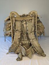
USGI ISSUED MOLLE II LARGE RUCKSACK MULTICAM OCP COMPLETE ASSEMBLY
$210.00

1977 Large Original Poster France Paris Seine Bridge Castle Vintage
$98.28