
Antique Map A Plan of the Harbour and Town of Louisburg in Island of Cape Breton For Sale

When you click on links to various merchants on this site and make a purchase, this can result in this site earning a commission. Affiliate programs and affiliations include, but are not limited to, the eBay Partner Network.

Antique Map A Plan of the Harbour and Town of Louisburg in Island of Cape Breton:
$125.00
This is a nice antique map A Plan of the Harbour and Town of Louisburg in the Island of Cape Breton Drawn on the Spot. In pretty good condition as the pics show with some discoloration seen in pics 8-10 and it comes exactly as shown. The frame measures 12 1/8" x 9 3/8"Keep in mind the shipping price also covers handling fees, packaging materials & time, not just postage.
Shipping Calculator is often wrong please contact me for an accurate international shipping price.
See our store for thousands of our other items.
D3a
Related Items:

Vintage 1903 NEW JERSEY Map 11"x14" Old Antique Original CAPE MAY SALEM WOODBURY
$21.56

Vintage 1903 LOUISIANA Map 11"x14" Old Antique Original ALEXANDRIA SHREVEPORT LA
$21.56
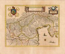
c. 1635 ANCIENT Antique Map Engraving of REPUBLIC OF VENICE by WILLEM J BLAEU
$415.00