
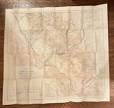
1948 MONTANA Official State Highway Road Map Helena Missoula Great Falls Glacier For Sale

When you click on links to various merchants on this site and make a purchase, this can result in this site earning a commission. Affiliate programs and affiliations include, but are not limited to, the eBay Partner Network.

1948 MONTANA Official State Highway Road Map Helena Missoula Great Falls Glacier:
$18.99
Vintage tall-formatfold-out 1948 official road map of Montana, printed more than 72 years ago.
- This map opens to a very generous 19\" x36\" and has great detail on old highway alignments and route numbers, with cartography by Rand McNally.
- The front cover shows a roadside sign forthe Gates of the Mountains and the Bear Tooth, four miles northeast onthe Missouri River.
- On the reverse side of the map there are inset plans of Anaconda, Billings, Bozeman, Butte, GreatFalls, Havre, Helena, Kalispell, Lewistown, Livingston, Miles City,Missoula, Yellowstone National Park, and Waterton-Glacier InternationalPeace Park.
- The map was issued by the Montana State Highway Commission, Helena, andis dated 1948. The back cover includes a message from Governor SamuelC. Ford.
- Condition: The map is invery good, lightly used condition, bright and clean, with a faint curl at the top edge, tiny breaks just starting on a couple of thefold corners, and no rips, tears, or writing. Pleasesee the scans and feel free to ask any questions.
- Buy with confidence! We arealways happy to combineshipping onthe purchase of multiple items — just make sure to pay for everythingat one time, not by SixBit\'s eCommerce Solution
Related Items: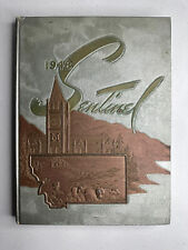
Vintage 1948 Montana State University Yearbook - Historical MSU Memorabilia Vint
$74.99
USGS Map Glacier National Park Montana Topographic 35x30.5”Ed. 1914 Reprint 1948
$35.00
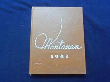
1948 MONTANAN MONTANA STATE UNIVERSITY YEARBOOK - BOZEMAN, MONTANA - YB 3091
$56.25